
Map of Canada — Provinces, Capitals & Geography for the Citizenship Test
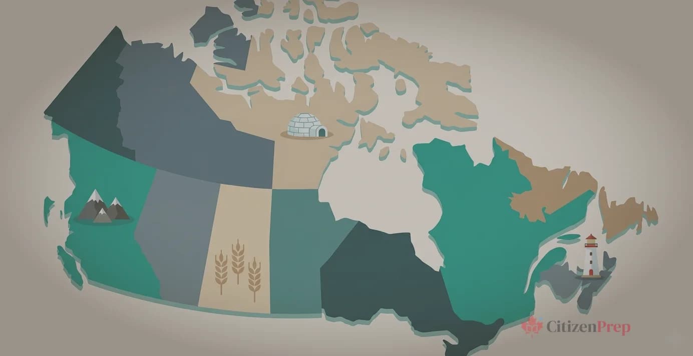
Map of Canada: Provinces, Capitals & Key Geography for the Citizenship Test
Geography is one of the more approachable sections of the Canadian citizenship test — but it still catches people off guard. You need to match 13 capitals to their provinces and territories, know which region each belongs to, and recall key facts like the largest province by area, the most populated province, and the world's highest tides.
The good news: the Discover Canada guide organizes this chapter by region, which makes it much easier to study in chunks. This guide follows the same structure. Every fact below comes directly from the official study material.
If you're building a broader study plan, check out our 14-day citizenship test study plan to see where geography fits alongside history and government topics.
How Many Provinces and Territories Does Canada Have?
Canada has 10 provinces and 3 territories, for a total of 13 jurisdictions. Each has its own capital city. The Discover Canada guide explicitly says: "You should know the capital of your province or territory as well as that of Canada."
Ottawa is the capital of Canada. It was chosen in 1857 by Queen Victoria and is located on the Ottawa River. The National Capital Region covers 4,700 square kilometres surrounding Ottawa.
Here is the complete quick-reference table:
| # | Province / Territory | Capital | Region | Joined Canada |
|---|---|---|---|---|
| 1 | Ontario | Toronto | Central Canada | 1867 |
| 2 | Quebec | Quebec City | Central Canada | 1867 |
| 3 | Nova Scotia | Halifax | Atlantic | 1867 |
| 4 | New Brunswick | Fredericton | Atlantic | 1867 |
| 5 | Manitoba | Winnipeg | Prairies | 1870 |
| 6 | British Columbia | Victoria | West Coast | 1871 |
| 7 | Prince Edward Island | Charlottetown | Atlantic | 1873 |
| 8 | Alberta | Edmonton | Prairies | 1905 |
| 9 | Saskatchewan | Regina | Prairies | 1905 |
| 10 | Newfoundland and Labrador | St. John's | Atlantic | 1949 |
| 11 | Northwest Territories | Yellowknife | Northern | 1870 |
| 12 | Yukon | Whitehorse | Northern | 1898 |
| 13 | Nunavut | Iqaluit | Northern | 1999 |
What Are Canada's Five Regions?
The Discover Canada guide divides Canada into five distinct regions. Learning geography by region is far more effective than memorizing 13 separate entries. Here is how the guide groups them:
- The Atlantic Provinces — Newfoundland and Labrador, Prince Edward Island, Nova Scotia, New Brunswick
- Central Canada — Quebec, Ontario
- The Prairie Provinces — Manitoba, Saskatchewan, Alberta
- The West Coast — British Columbia
- The Northern Territories — Yukon, Northwest Territories, Nunavut
Canada is the second largest country on earth at approximately 10 million square kilometres. Three oceans border its frontiers: the Pacific Ocean to the west, the Atlantic Ocean to the east, and the Arctic Ocean to the north. The southern boundary is shared with the United States.
Atlantic Canada: Newfoundland and Labrador, PEI, Nova Scotia, New Brunswick
The four Atlantic provinces are located on Canada's east coast. The Atlantic Ocean gives the region cool winters and cool, humid summers. These provinces have a long history built on fishing, farming, forestry, and mining.
Newfoundland and Labrador — Capital: St. John's
- The most easterly point in North America — so far east it has its own time zone
- Oldest colony of the British Empire
- Long known for fisheries and coastal fishing villages
- Off-shore oil and gas extraction now a major part of the economy
- Labrador has immense hydro-electric resources
- Joined Canada in 1949 — the last province to join Confederation
Prince Edward Island — Capital: Charlottetown
- Canada's smallest province
- Known for beaches, red soil, and agriculture (especially potatoes)
- Birthplace of Confederation — the 1864 conference that led to Canada's formation
- Connected to the mainland by the Confederation Bridge, one of the longest continuous multispan bridges in the world
- Setting of Anne of Green Gables by Lucy Maud Montgomery
Nova Scotia — Capital: Halifax
- The most populous Atlantic Province
- Known as the historic gateway to Canada
- Home to the Bay of Fundy, which has the world's highest tides
- Halifax is Canada's largest east coast port — deep-water and ice-free
- Home to Canada's largest naval base
- Over 700 annual festivals, including the Halifax military tattoo
- Rich Celtic and Gaelic traditions
New Brunswick — Capital: Fredericton
- Canada's only officially bilingual province — about one-third of the population lives and works in French
- Founded by the United Empire Loyalists
- Has the second largest river system on North America's Atlantic coastline (the St. John River system)
- Saint John is the largest city and main port; Moncton is the principal Francophone Acadian centre
- Key industries: forestry, agriculture, fisheries, mining, food processing, and tourism
Which province is the birthplace of Confederation?
Central Canada: Quebec and Ontario
Central Canada is where more than half of all Canadians live. The region — concentrated around the Great Lakes and the St. Lawrence River — is Canada's industrial and manufacturing heartland. Together, Ontario and Quebec produce more than three-quarters of all Canadian manufactured goods.
Quebec — Capital: Quebec City
- Population: nearly 8 million (per Discover Canada)
- More than three-quarters speak French as their first language
- Canada's main producer of pulp and paper
- Canada's largest producer of hydro-electricity
- Leaders in pharmaceuticals and aeronautics
- Montreal is Canada's second largest city and the second largest mainly French-speaking city in the world after Paris
- Largest province by area — though Discover Canada doesn't state this explicitly, it is a commonly tested fact
Ontario — Capital: Toronto
- Population: more than 12 million — over one-third of all Canadians
- Most populous province in Canada
- Toronto is the largest city in Canada and the country's main financial centre
- Niagara region known for vineyards, wines, and fruit crops
- Has the largest French-speaking population outside of Quebec
- Founded by United Empire Loyalists
- Five Great Lakes between Ontario and the U.S.: Lake Ontario, Lake Erie, Lake Huron, Lake Michigan (in the U.S.), and Lake Superior — the largest freshwater lake in the world
Note for test prep: The Discover Canada guide says Canada's population is "about 34 million." The actual population in 2026 is closer to 42 million. For the citizenship test, answer based on the guide's figure unless the question specifically refers to current statistics.
Prairie Provinces: Manitoba, Saskatchewan, Alberta
The three Prairie Provinces are rich in energy resources and contain some of the most fertile farmland in the world. The region is mostly dry, with cold winters and hot summers.
Manitoba — Capital: Winnipeg
- Economy based on agriculture, mining, and hydro-electric power
- Portage and Main in Winnipeg's Exchange District — the most famous street intersection in Canada
- St. Boniface is Western Canada's largest Francophone community (45,000)
- Important centre of Ukrainian culture — 14% report Ukrainian origins
- Largest Aboriginal population of any province at over 15%
Saskatchewan — Capital: Regina
- Once known as the "breadbasket of the world" and the "wheat province"
- Has 40% of the arable land in Canada
- Canada's largest producer of grains and oilseeds
- World's richest deposits of uranium and potash
- Regina is home to the RCMP training academy
- Saskatoon is the largest city and mining industry headquarters
Alberta — Capital: Edmonton
- The most populous Prairie province
- Named after Princess Louise Caroline Alberta, fourth daughter of Queen Victoria (as was Lake Louise)
- Five national parks, including Banff National Park (established 1885)
- The Badlands contain some of the world's richest deposits of prehistoric fossils and dinosaur finds
- Canada's largest producer of oil and gas
- Vast cattle ranches make Canada one of the world's major beef producers
West Coast: British Columbia
British Columbia is Canada's westernmost province, located on the Pacific coast.
British Columbia — Capital: Victoria
- Population: 4 million (per Discover Canada)
- The Port of Vancouver is Canada's largest and busiest port — the gateway to the Asia-Pacific
- About half of all goods produced in B.C. are forestry products — the most valuable forestry industry in Canada
- Known for mining, fishing, and the fruit orchards and wine industry of the Okanagan Valley
- Has approximately 600 provincial parks — the most extensive park system in Canada
- Chinese and Punjabi are the most spoken languages in B.C. cities after English
- Victoria is a tourist centre and headquarters of the navy's Pacific fleet
Northern Territories: Yukon, Northwest Territories, Nunavut
The three northern territories contain one-third of Canada's land mass but have a combined population of only about 100,000. The North is often called the "Land of the Midnight Sun" because at the height of summer, daylight can last up to 24 hours. In winter, the sun disappears for three months.
Much of the North is made up of tundra — vast, rocky Arctic plain with no trees and permanently frozen soil.
Yukon — Capital: Whitehorse
- Famous for the Gold Rush of the 1890s, celebrated in the poetry of Robert W. Service
- Holds the record for the coldest temperature ever recorded in Canada: -63 degrees C
- Home to Mount Logan, the highest mountain in Canada, named after Sir William Logan
- The White Pass and Yukon Railway (opened 1900) provides a spectacular tourist excursion from Skagway, Alaska to Whitehorse
Northwest Territories — Capital: Yellowknife
- Originally formed in 1870 from Rupert's Land and the North-Western Territory
- Yellowknife (population 20,000) is called the "diamond capital of North America"
- More than half the population is Aboriginal (Dene, Inuit, and Metis)
- The Mackenzie River at 4,200 kilometres is the second-longest river system in North America after the Mississippi
Nunavut — Capital: Iqaluit
- Canada's newest territory, established in 1999 from the eastern part of the Northwest Territories
- "Nunavut" means "our land" in Inuktitut
- Population is about 85% Inuit
- Inuktitut is an official language and the first language in schools
- The 19-member Legislative Assembly chooses a premier and ministers by consensus (no political parties)
- Iqaluit was formerly called Frobisher Bay after English explorer Martin Frobisher
The Canadian Rangers, part of the Canadian Forces Reserves, patrol the North by snowmobile and all-terrain vehicle, helping maintain Canada's sovereignty in the Arctic.
Key Geographic Facts to Memorize for the Test
These are high-frequency test facts. If you're short on time, focus here:
| Fact | Answer |
|---|---|
| Second largest country in the world | Canada (10 million sq km) |
| Three oceans bordering Canada | Pacific, Atlantic, Arctic |
| Capital of Canada | Ottawa (chosen 1857 by Queen Victoria) |
| Smallest province | Prince Edward Island |
| Most populous province | Ontario (12+ million) |
| Largest province by area | Quebec |
| Newest territory | Nunavut (1999) |
| Only officially bilingual province | New Brunswick |
| Highest mountain | Mount Logan (Yukon) |
| Longest river system | Mackenzie River (4,200 km) |
| Largest freshwater lake in the world | Lake Superior |
| World's highest tides | Bay of Fundy (Nova Scotia) |
| Coldest temperature recorded in Canada | -63 degrees C (Yukon) |
| Largest and busiest port | Port of Vancouver |
| "Diamond capital of North America" | Yellowknife |
| "Breadbasket of the world" | Saskatchewan |
| Birthplace of Confederation | Charlottetown, PEI |
| RCMP training academy location | Regina, Saskatchewan |
| Five regions of Canada | Atlantic, Central, Prairies, West Coast, Northern |
| Four original Confederation provinces (1867) | ON, QC, NS, NB |
For a complete overview of all testable topics, see our citizenship test study guide. And if geography feels like one of the easier topics for you, redirect your energy to the hardest citizenship test topics — history and government carry more weight.
How to Study Canada's Geography Efficiently
Geography is covered in Chapter 11 (Canada's Regions) of the Discover Canada guide. It is one of the shorter chapters, but it is packed with specific facts — capitals, nicknames, key landmarks, and population figures.
Here are three practical approaches:
1. Study by region, not alphabetically. The five-region structure groups provinces with shared characteristics. Atlantic provinces share ocean industries. Prairie provinces share agriculture and energy. This context makes individual facts stick.
2. Focus on the "only" and "most" facts. The test loves superlatives: the only bilingual province (New Brunswick), the smallest province (PEI), the most populous (Ontario), the highest mountain (Mount Logan). These are high-probability questions.
3. Use the capital-to-province matching drill. Cover the "Capital" column in the table above and quiz yourself. Then reverse it — cover the province names and see if you can match from capitals. This simple technique uses active recall, which research shows is far more effective than re-reading.
Practice with real test-format questions on the CitizenPrep daily challenge to see how geography questions actually appear on the test.
Frequently Asked Questions
How many provinces and territories does Canada have?
Canada has 10 provinces and 3 territories, for a total of 13. The provinces are Newfoundland and Labrador, Prince Edward Island, Nova Scotia, New Brunswick, Quebec, Ontario, Manitoba, Saskatchewan, Alberta, and British Columbia. The territories are Yukon, Northwest Territories, and Nunavut.
What is the difference between a province and a territory?
Provinces receive their power directly from Canada's Constitution, while territories receive their authority from the federal government. In practice, this means territories have fewer legislative powers. All three territories are in Canada's North: Yukon, Northwest Territories, and Nunavut.
What is the capital of Canada?
Ottawa, Ontario is the capital of Canada. It was chosen as the capital in 1857 by Queen Victoria. Ottawa is located on the Ottawa River and is Canada's fourth largest metropolitan area.
What is the largest province in Canada?
Quebec is the largest province by area. Ontario is the largest by population, with more than 12 million people — over one-third of all Canadians. The test may ask about either, so note whether the question says "largest" (area) or "most populous" (population).
What is the smallest province in Canada?
Prince Edward Island is the smallest province. Despite its size, it holds an outsized place in Canadian history as the birthplace of Confederation — the 1864 Charlottetown Conference that led to the creation of Canada.
Which province is the birthplace of Confederation?
Prince Edward Island is the birthplace of Confederation. The 1864 Charlottetown Conference, where the idea of uniting the British North American colonies was first discussed, took place there. The Confederation Bridge connects PEI to mainland New Brunswick.
What is the newest territory in Canada?
Nunavut is the newest territory, established in 1999 from the eastern part of the Northwest Territories. The name means "our land" in Inuktitut. About 85% of the population is Inuit.
Which four provinces formed Confederation in 1867?
Ontario, Quebec, Nova Scotia, and New Brunswick were the four original provinces that formed the Dominion of Canada on July 1, 1867, through the British North America Act.
Ready to test your geography knowledge with real practice questions? CitizenPrep covers 850+ concepts from the Discover Canada guide, including 80+ geography study cards covering every province, territory, capital, and key landmark. Start free — no credit card required.